Trek to Chilinji Pass - Travel Blog
Chilinji trek at an altitude of 5140m connects Chapursan valley in Upper Gojal with Iskoman valley in Ghizer.
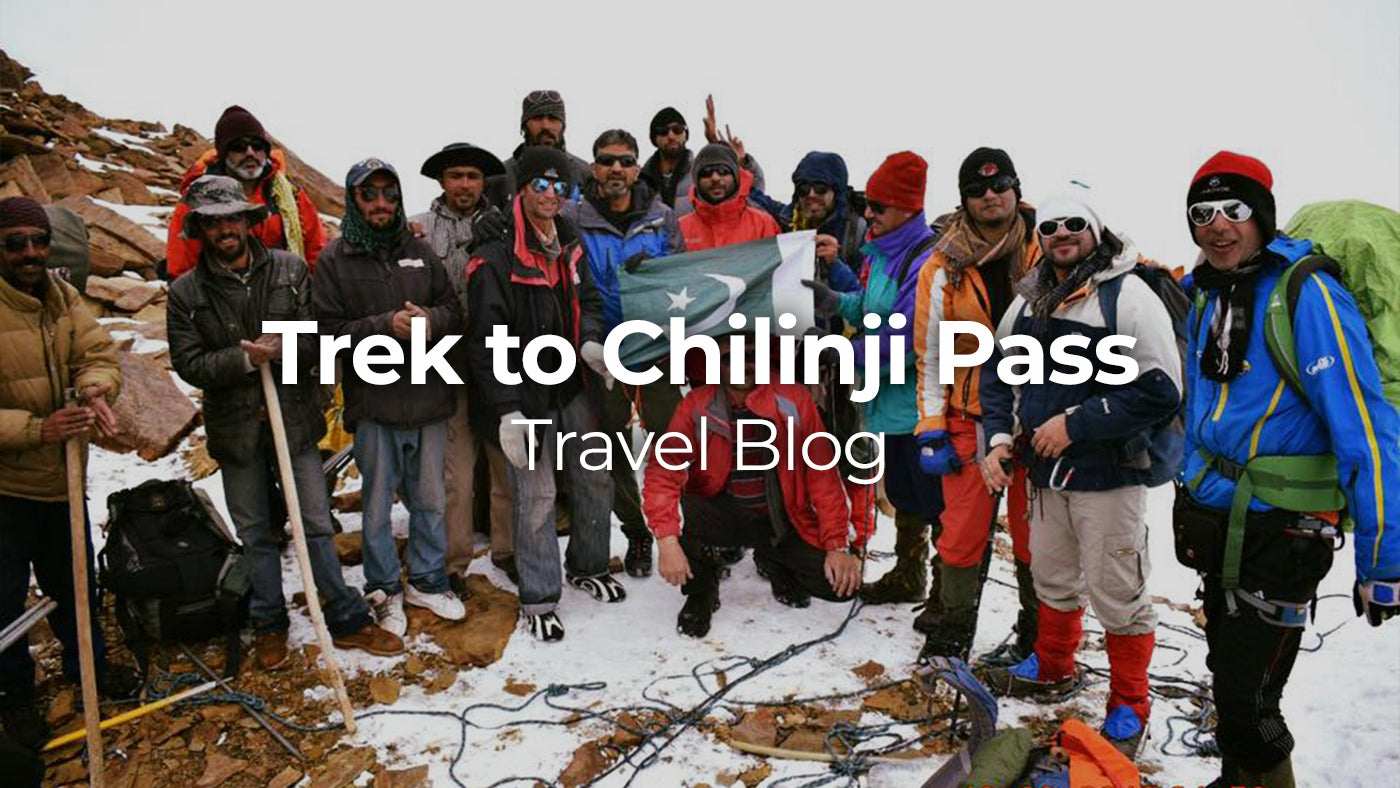
The story of Chilinji begins in 2009 when we heard about this pass from Ahmed Mujtaba and decided to do it coming from Ishkoman valley while coming from Broghil and Karomber lake. When we reached Swinj hoping to find porters who we could hire for crossing Chilinji and talked to gujjars there on the possibility, they unanimously refused to go with us and rejected the idea of crossing Chilinji citing difficulty of pass. Now that we have crossed Chilinji successfully from Chapursan side dealing with all of the crevasses and scree, we realize that we were fortunate to be refused by porters back then. Considering we neither had appropriate technical equipment at that time nor were we technically that strong, Chilinji attempt would probably have been catastrophic - specially from this side where the ascend is hell steep. Following years, area beyond Baba Ghundi became restricted by security agencies because of its proximity with Afghan border. Last year, we received news of two groups successfully crossing the pass and soon afterwards started working on it. My first priority for this year was to traverse Central Asia states but when it couldn't get materialised this year, Chilinji became the uncontested target. It took 7 long years but we made it to the Chilinji pass top eventually :)
Considering the Haramosh experience that didn't go very well with 12 group members, I wanted the group to remain short this time. However, we eventually had to get settled with 9 In the end including Dr. Hadi, Shoaib, Athar, Kashif, Dr. Mujtaba, Saeed, Col. Ahsan and Ali. Dr. Hadi lead the group. Col. Ahsan's addition turned out to be very useful because of his exposure and technical knowledge. He had successfully lead the Pak-Australia joint army expedition to Spantik (7027m) back in 2011. We missed Ezaz this time as he had to drop because of sciatica pain at the last hour.
Chilinij pass is almost unanimously crossed from Chapursan side. The scree on the other side would definitely make it a hard choice. We had pre-arranged the porters and guide through Alam Jan who is the famous guide form Chapursan and runs Pamir Sarai. Unfortunately because of knee pain, he no more leads the groups himself. He is the best guy to arrange for porters and the route. Alam Jan can be contacted at 0355-5105186/0346-5226623 or at pamirtrails@gmail.com in case numbers don't go through.
The other challenge Chilinji has the requirement of army permission. There is an army post at Baba Ghundi headed by JCO who would not let the group pass by unless he gets approval and green light from FCNA H/Q in Gilgit. This has caused different groups delays. Fortunately in our case we had a serving officer as part of our group so we managed to get permission without any delay however even then it consumed a lot of time and contacting at our end before the trek and at Baba Ghundi.
Day1 - Baba Ghundi to Biatar
Baba Ghundi shrine is located at an altitude of 3530m. The trek starts from the shrine gently and remains almost flat for initial couple of hours till YarzYarz - the last summer settlement consisting of a few huts. The ascend starts after those settlements but remains gradual. Being the first day of a trek well above sea level and with a backpack on your back, the pace remains slow however the walk prepares you well mentally and physically for the days to come. Trek touches the lateral moraine of Biatar glacier just briefly before turning right. We reached Biatar in around 6 hours while the total ascend was 460m. This is the last green camping site before jungle camp.
Day2 - Biatar to Chilinji Base Camp
This is a tough day with ascend and altitude gain all the way. There are two options to reach Chilinji base from here. One is to gain height steeply in the start to reach Biatar glacier and move along it. The other if one wants to avoid the rough glacier boulders is to move along the river. The first challenge on this way is the stream crossing. With an early morning start when water level is low, one can find spots with boulders to step on and cross stream without getting your feet wet. Soon after crossing the stream, the second challenge is the steep ascend of around 200 meters involving traversing a narrow path on the rocks. This is a dangerous patch and every step needs to be put very carefully. Ascend becomes a bit mild after this steep ascend however it doesn’t let you relax too much with a constant altitude gain. Chilinji base is a very small flat patch with a few camping platforms built by locals. Only water source is the big glacier ice patch near the campsite. This campsite is located at 4600m with a total gain of 600 meters from the base.
Though we were dead tired after reaching base and our bodies were not fully acclimatized either, Dr. Hadi suggested we should move towards high camp and go as far as possible to make the next day pass crossing shorter. We walked for another 45 minutes and decided to camp on a patch of scree and rocks. This was not a very good place to camp considering we left flat camping platforms behind. Even at the proper high camp, night would be very uncomfortable. I would recommend staying at Chilinji base camp and attempting the pass from there with an early pre-dawn start. For us unfortunately the weather turned bad that night and it kept snow falling the whole night and morning. We had to make a forced stay at this unpleasant campsite for another day.

Day3 - Chilinji Base to Jungle Camp via Chilinji Pass
Next day, we woke up to Dr. Hadi's call at 3:30 AM with a cloudy sky but no snowfall. Although there were no weather guarantees, it was time to attempt the pass. Having spent an extra day at this altitude made our bodies a bit acclimatised. Body acclimatisation is one of the biggest challenges of this trek. Rarely have we been to above 5000m altitude on just the third day. Like all other passes day, this became a very long and hectic day. The path to pass from high camp is highly crevasses and in bad weather can give you really tough time like it did to us. What seemed from high camp like a distance of a couple of hours max took more than four hours. We were roped up and had to deal with crevasses. Our guide Hafeez fell into the crevasses many times and rest of the team had to jump that line.

Once at the top, descend looks hell scary. It is almost an angle of 60/70 degrees for initial 300 meters. On top of that it is all scree where how one descends is both tricky and funny. Any attempt to set step and hold it is a waste so all one needs to do is to take fast steps and sort of slide while trying to keep the balance and posture. It is a hard test for shoes as well. Only after initial 300 meters, it becomes a bit stable however scree remains your companion till at the start of jungle. The best spot to camp in Jungle camp is not at the start rather after a walk of almost an hour with exact 1600m descend from the top. This is a flat spot deep in the jungle along with water source where one can pitch tents comfortably.


Weather remained bad throughout the day without sun showing its face. It was raining heavily when we reached jungle camp. At this point we had to take decision of continuing our plan towards Karomber and Broghil or to take a shorter route towards Ishkoman. We contacted a contact in MET department on satellite phone to get weather forecast of the area for next few days. We received the response that it is not going to get clear before next 3/4 days. There was no point of walking the Broghil valley in rain so we decided to cut our trek short and exit via Ishkoman valley instead.
Day4 - Jungle Camp to Virgoth
From Jungle camp to the Ishkoman river is another 60-90 minutes walk involving a few tricky narrow crossings on the rocks. As there are no settlements as such in jungle camp or above, the path seems very less used and at places demands struggle in the woods and rocks. At the bottom along with river, there are a few rough gujjar huts however they were empty for this season. At this point, we found a fixed pulley apparently setup by locals which was no more in active use. We had to make a decision of either using this unstable pulley or to walk another few hours up to the glacier from where we could cross the river and come back to the same point at the other end of river. That meant spending extra 5-6 hours which nobody among us wanted to do. So we decided to test the pulley. Col. Ahsan took the lead and set up pulley and safety anchors. The steel wire seems okay however it wasn't that tight and was very much titled so we re-fixed boulders that were used to anchored and uplifted it about a feet or so. We then used our own single pulley and one of our porters was able to reach the other side. We decided to cross our luggage and rest of the team members the other day.
Next day, we started our activity with a few porters going to the other end with rope and strengthened the anchor there. Then one by one, our team members and luggage bags were made to cross. This long exercise took 4.5 long hours but we eventually managed to cross it to the other end safe and sound. Col. Ahsan was the last person who wrapped up the stuff and came to this side of the river. He was welcomed as a hero by porters with slogans and cheers.

Shutergurden was the next challenge which was although not that scary as it was 6 years ago it still takes courage and stamina. The rock crossings are narrow and the dip is hundreds of feet down to the glacier, where one wrong step could make you history. The reward is however unmatched in the form of Virgoth that offers one of the best places of North. It is a vast green land with some huts built by gujjars. Like last time, the hut was empty that we happily occupied. This hut offers the comfort and luxury that only trekkers can feel. With the Chilinji top done and end in sight, it was time to celeberate. We managed to get one goat from a gujjar and enjoyed bakra feast there. Virgoth was so tempting that the whole group decided to spend an extra rest day there just to enjoy the peace and serenity of this place.
Day5 - Virgoth to Mitramdan
We woke up next morning without worrying about packing up the rucksacks. However, weather didn't let us keep that feeling for too long and suddenly dense clouds started appearing. It was time to take the decision again and with heavy heart, we decided to say Goodbye to Virgoth and started moving towards Mitramdan.
Walk to Mitramdan is the last leg of trek that takes one to back in population and civilisation. It's a walk of 5-6 hours from Virgoth to Mitramdan. There are two options from here. One is to keep moving along the river and cross it after Pekhin. The other that we opted is to cross the river which is freezing cold and fast but knee deep. After another hour from Pekhin, this exercise needs to be repeated as river moves along the vertical rocks or one can take the longer route from above the ridge. From Mitramdan, jeeps can be arranged. If jeep is not readily available, it is another couple of hours of boring walk till Borith where a flood took away the bridge some years back and it needs to be crossed by foot. From Borith, jeep can take you to Gilgit in 5-6 hours.
Sayed Akbar Siddu
Informative
loved it